Bridget Gleeson writer + illustrator
I make maps: you should, too.
Maps you make for work, maps you make for fun, maps that inspire you, maps that force you to be practical, maps that cause you to fight with your boyfriend.
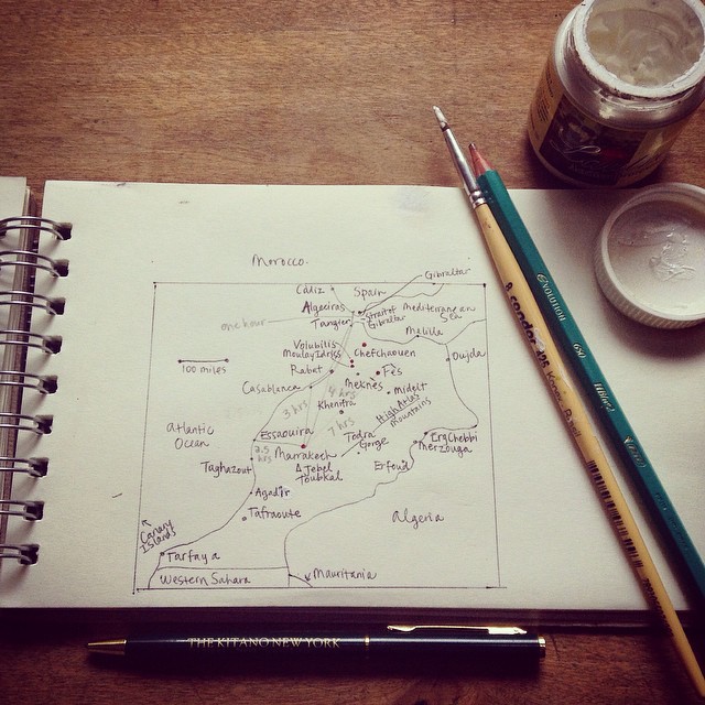
This weekend, I’ve been working on two things: planning an upcoming trip to Morocco, and writing a feature on the life and travels of Antoine de Saint-Exupéry. So I’m in the mood for maps. I like to look at maps, and I like to make my own. Drawing a map is the quickest way to familiarize yourself with a foreign place.
First, I stare at some existing maps, and compare them, looking up the names of remote mountain ranges. (And here come the questions: what is ‘Jbel Toubkal?’ Is the Western Sahara a country or a region? How long does it take to cross the Strait of Gibraltar by boat?) Then you break out your own paper and pencils – pencils come with erasers – and make your own version. In my experience, drawing your own map and sketching out possible routes of travel – it’s about the most fun you can have on a Saturday afternoon.
But what can I say, I’m into maps. That’s part of the reason why I got into this line of work. When I first started working for Lonely Planet, I was trained to work with the real map-makers – the in-house cartographers working at the Melbourne office. That mini-education has been quite useful. I had to think about collecting information on the ground, and how to accurately translate that to the thousands of people who would eventually look at the published map.
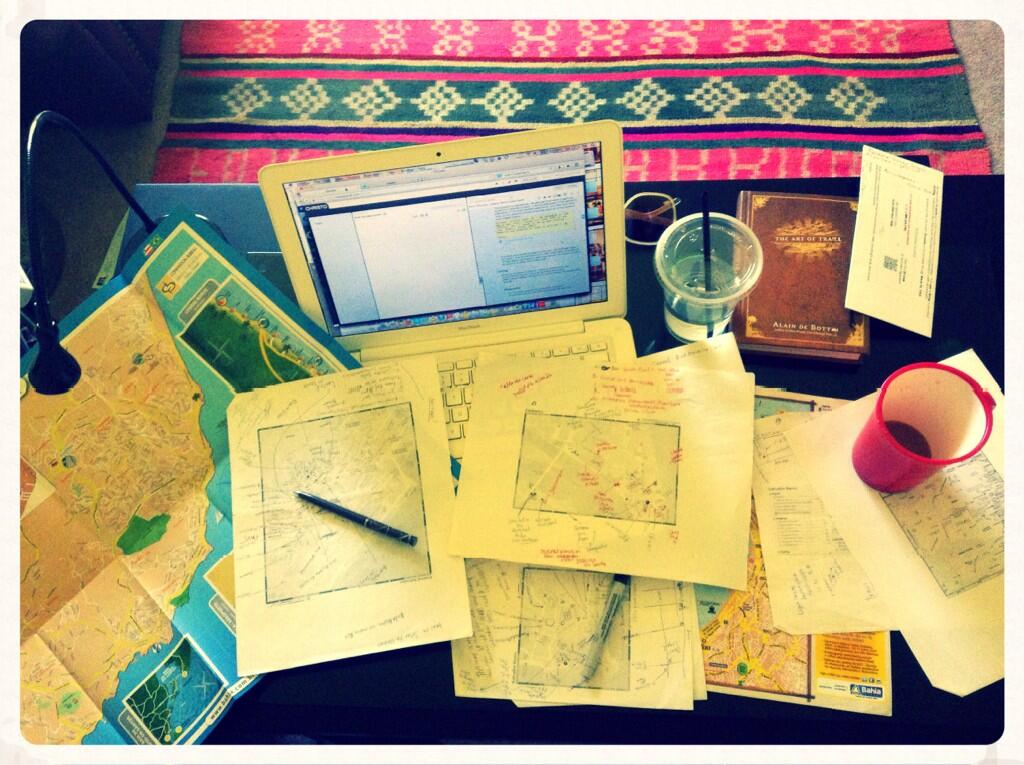
Below, my desk on the day of the Lonely Planet deadline for the most recent Brazil guidebook. *Stressful.*
Here are a few examples of maps I’ve worked on in recent years, for work or play:
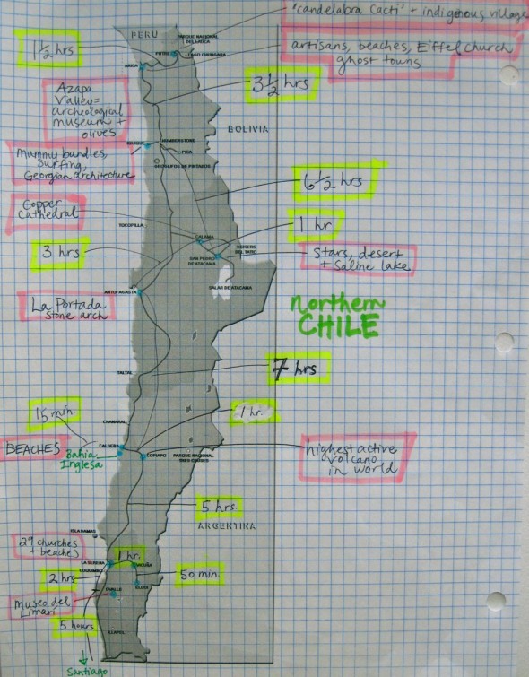
The Big Picture map (for reference when you’re on a bus, middle of the night, middle of nowhere.) I was assigned to cover central and northern Chile for Lonely Planet’s South America on a Shoestring. I drew this for the cover of my notebook so I could remember where I was going, and why, and how far the Azapa Valley is from the border of Peru.
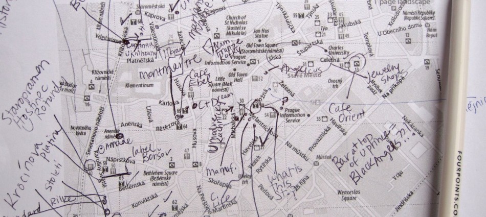
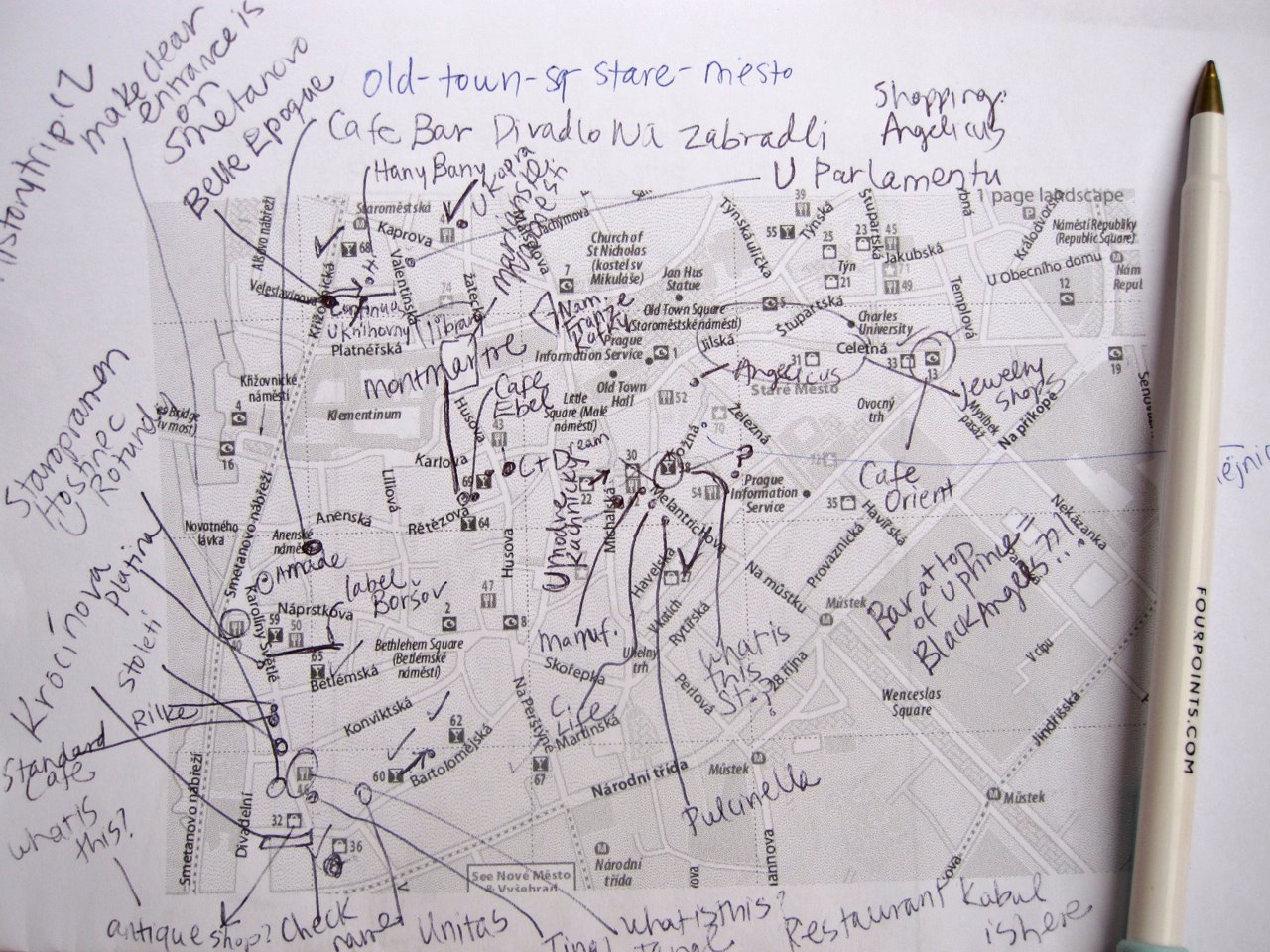
The Little Picture map (for publication / for sticklers / for travelers who need to know exactly where they are at all times.) Yep, that’s Staré Město, Praha. I used to live in Prague, but I never realized how many street names there were until Lonely Planet sent me on a map-making mission for Pocket Prague.
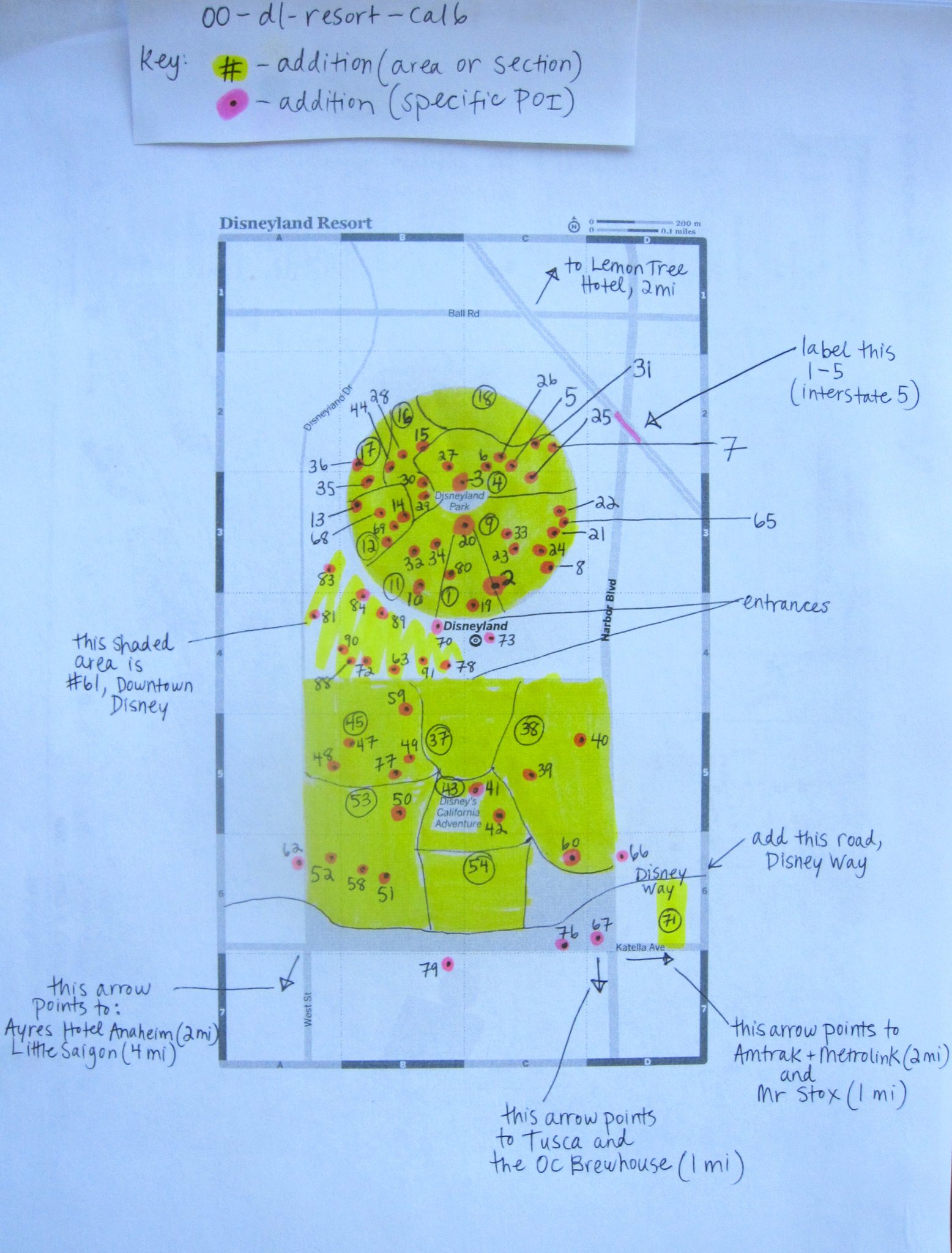
‘The Only Map I Trust Is the One I Make Myself’ map. This is a map I made of Disneyland for one of Lonely Planet’s California guidebooks. You’re right if you think that Disneyland already has their own map – one that’s highly detailed and, of course, accurate. It’s Disneyland. But we made our own version of it anyway. Partly so I could put a ‘Little Saigon, 4 miles’ signpost on it. I really like Little Saigon.
The ‘But I Don’t Want to Use a Computer’ map. ‘You know I like to draw maps,’ I said. ‘But it’s easier to make with Adobe software,’ he said. ‘Well, this relationship isn’t going to work out,’ we both thought to ourselves. (Just kidding. The relationship didn’t actually work out, but we did have a wonderful trip to Spain and Portugal.)
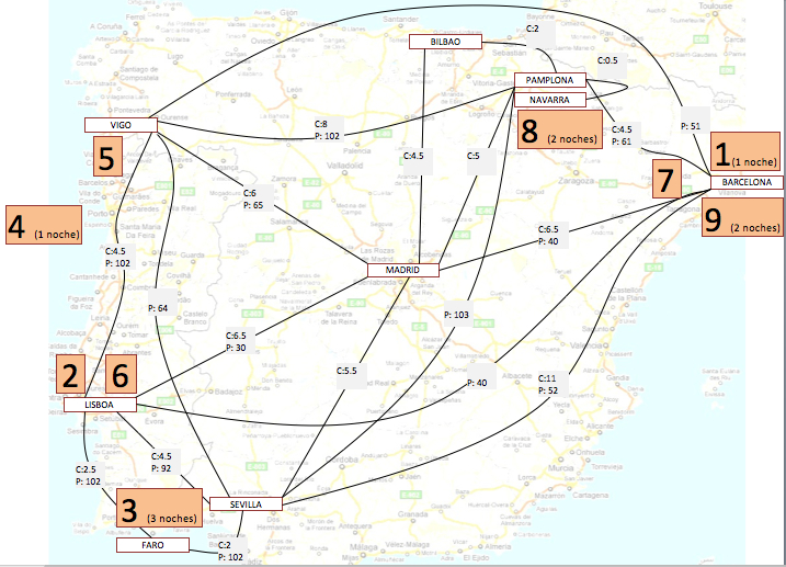
And after all, what are romantic relationships if not learning experiences? In the above case, I learned that a pencil + eraser combo is not for everyone. Some people like to use computers. If that’s you, check out Scribble Maps. If you’re more artistic, look for inspiration over at They Draw & Travel.
Happy map-making! I’ll report back from Jbel Toubkal, also known as توبقال.
_______________________________________